June 29, 2025
As I usually do I like to wrap up a trip with some data and some commentary.
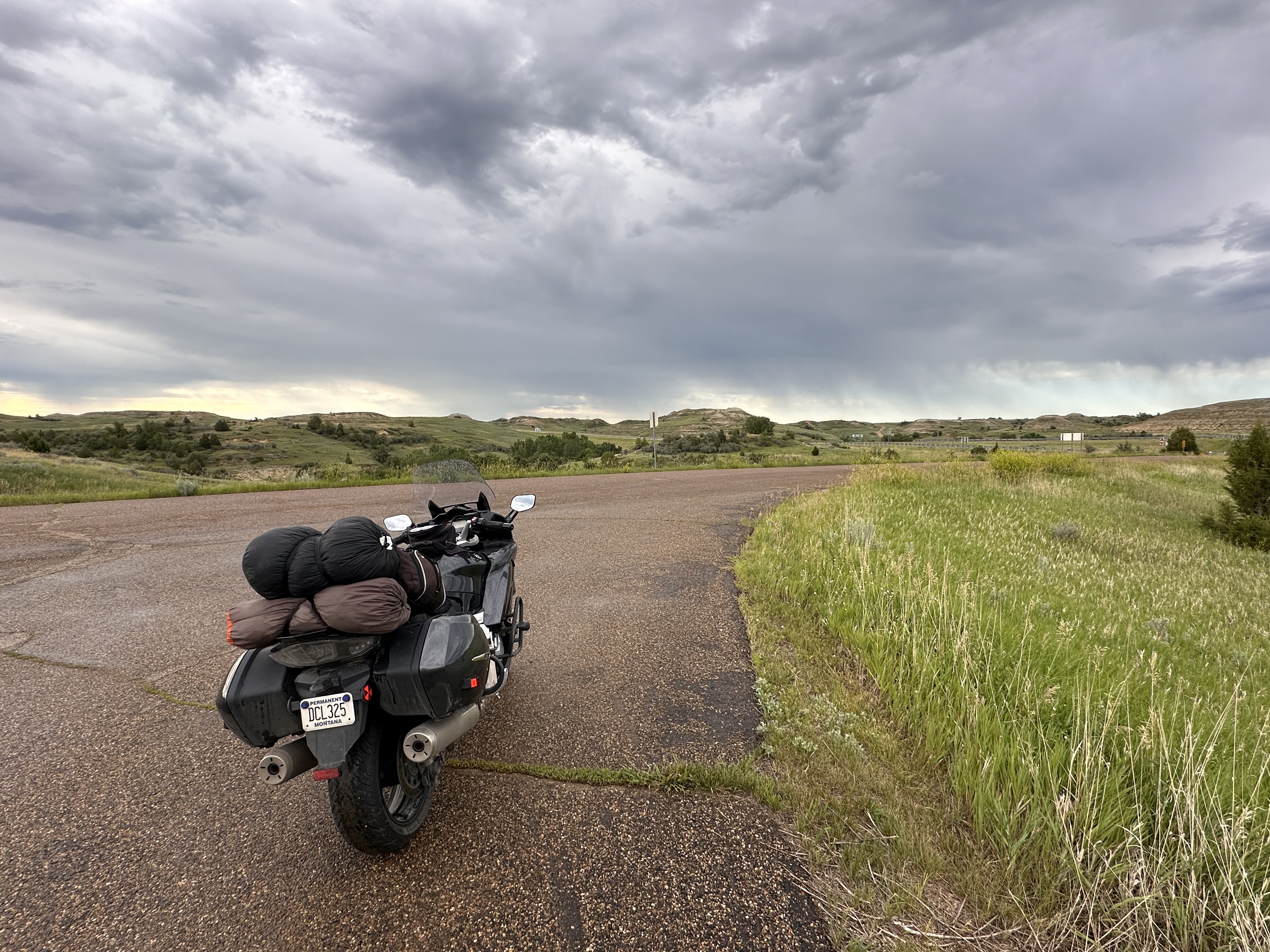
Total miles ridden: 5,217
Longest day: 447 miles, Albert Lea to Clear Lake and then to Medora area
Shortest day: 222 miles, returning from West Virginia to Pittsburgh
Days traveling: 15 days riding, 15 days hanging out in Pittsburgh
Nights camping out: 12
Number of gas stops: 33
Total gas used: 100.43 gallons
Total cost of gas: $316.87
Average miles per gallon: 51.94 mpg
Cost of campsites: I didn’t keep track of those this time but the one night in a motel was $115
Note that the math shows that the average cost of gas was $3.16/gallon which I find interesting. The average cost of gasoline since 1975, adjusted for inflation, is $3.21/gallon. While people whine about gas prices, I contend that gas is about the same over time BUT we use less of it since our vehicles are more fuel efficient than in the past. With my motorcycle getting about 52 mpg, it costs me 6 cents per mile. The most expensive gas was $3.60 in Dickinson, ND, Union, PA, and Hickory, PA. The least expensive was in Center, ND at $2.79/gallon. I note that there the only option was 87 regular which is what I run.
Now some thoughts and things I didn’t think of when I made the daily entries. This trip was different is in that my wife and I camped our way across country but did not travel together. She took the freeways as that is how she easily finds charging stations for her EV. I like to stick to the backroads because it’s more relaxing and the scenery is better. We’d meet up at the end of the day wherever she’s set up a campsite reservation. We could keep track of each others location sharing that on our phones. I can also find the car on the Tesla app or Bart the Dog via his AirTag.
One advantage of this method of travel, for me, is that I could stow some of my gear in the car and not have to carry it on the bike. For the most part this was extra stuff that I’d want to have for our extended stay in Pittsburgh: clothes, my drawing stool, etc. I did keep everything I needed to be independent on the bike in case something happened and we didn’t meet up so I had all my camping gear with me.
The motorcycle performed flawlessly. Except for that one incident where I had to use my OBD2 reader to clear a code caused by a rough railroad crossing, all I did was put gas in it and change the oil when I arrived in Pittsburgh. It just runs and does that as fast as I dare to make it go. I have grown into a much more confident rider over the years so I’m able to push the bike a bit more, especially in the twisty roads. The cruise control is a feature I would never want to do without. It saves wear and tear on my wrist which has some carpal tunnel issues. The heated grips came in pretty handy when riding in the rain. It wasn’t that cold out but with wet gloves and wind it felt like it.
Oh, another bike related issue, when I had to use the OBD2 reader to clear that error code (Day 26), I found a nail in my rear tire. It was small and very rusty and had gone sideways through one tread knob into another. It didn’t look like it had punctured the tire. Where it went between the two knobs, it had broken in two so I pulled the head out and left the other. I didn’t want to create a problem where there wasn’t one. Now that I’m back I’ll extract that little piece out if it is still there. Since it was in sideways, I didn’t think it was a problem. No photo because I didn’t want to make it famous.
Rain. I must say something about rain. I did not keep track but I’m guessing that about half the time I rode, I was in the rain. Because of past experiences riding in those conditions, I’m pretty comfortable these days and feel that the bike handles just about as well as it does on dry roads. This is largely due to the Michelin tires I’m using. They just feel sticky to the road, wet or dry.
But staying dry in the rain is just not going to happen. I mean I do stay mostly dry but I’m going to get wet. Rather than a full rain suit I have a rain liner that zips inside my jacket. The jacket gets wet but I stay dry, mostly. I have rain paints that pull on over my riding pants and I think I didn’t have them hiked up high enough and water came off the jacket liner and ran down above the rain pants. Lesson learned. I really don’t want to invest, carry, or wear a full rain suit. I’ve also learned to tighten up the cuffs on my sleeves to keep the water from blowing in there. I have gauntlet-style gloves for cold weather but just opted for my shorter gloves for this ride. It’s inevitable that some water is going to get into the helmet although I was mostly dry there but some water will run down my neck. If I wear a neck gaiter thing that might help that.
Humidity. I experienced more of that on this trip than on other trips in the same region. Hot, sticky, and nothing wet ever dries out. I probably dislike the humidity more than the heat. It wasn’t too bad in the mornings when I’d go out for my runs but would go up as the day went on. Of course, near the end of our stay in Pittsburgh, they started having a record breaking heat wave which was nice to escape from.
I had an assortment of little experiences that stick in my mind but didn’t write about when they happened. I was on my way out of Pennsylvania and stopped at a rest area along a nice lake. I’d gone around the restrooms to take a photo of the lake and when I came back to my bike a guy was looking at it and struck up a conversation, mostly about riding which he said he can’t do anymore. He asked where I was riding from and I told him “Pittsburgh” and he said he grew up near there but now lives in southern Ohio. Then, as he lights up a little cigar, tells me that the county he lives in has the highest cancer rate in the nation. He told me that he’d never live in PA again because, as a commonwealth, they have more laws and rules than anywhere. He also doesn’t like how the state accommodates “all those ‘Alphabet’ people.” OK, time to hit the road.
Little towns. Lots of them. Sometime I wonder how they survive and what the people there do a for a living. I wrote earlier about the depression economy in parts of West Virginia and I didn’t see anything as poor at that through Ohio to North Dakota but some little towns are quite quiet. Some business building are closed. However, in many of these towns there lots of beautiful homes and nice parks. Hickory, PA was one of those. There were some nice Victorian-style homes there that made me want to learn more about the place.
Of course, many of the small towns survive because of the agricultural industry that surrounds them. What’s great about these backroads tours is that one really does get a realistic picture of how much of the country is devoted to farming. In the west we see lots of cattle operations but through the Midwest, it’s farming, mostly corn with a fair amount of soybeans. Hundreds of miles of nothing but cultivated farmland. Grain silos are everywhere. It’s quite beautiful.
Camping gear: what can I say? After many trips I have what I need and didn’t want for anything. My MSR stove from 1980 is still working fine. One change I made to my gear was to add a MagSafe charger to my tank bag for charging my phone. I’d been having trouble with the charging port before I left. I cleaned it and even used a bit of DeOxit, but the cord had to be in just the right angle for it to charge. For the ride to Pittsburgh I couldn’t use the MagSafe because I didn’t have USB-C socket on the bike and the adapter I’d picked up wasn’t rated for charging. By the time I got to Pittsburgh, the charging port seemed to heal itself but my son gave me a proper adapter and I was able to use the MagSafe for the rest of the trip. It’s handier to remove it from the back of the phone when I take it out of the tank bag than using the cable version. Geeky stuff.
I’ll also mention that when I was at the reggae concert, it was well after dark and I was walking around on my way back from the stage when I stopped to pick up some litter. At first I thought “Wow!” but upon closer inspection, not so wow.
That about wraps up this adventure. Right now have no plans for the next big ride but I know I’ll be doing some day rides in the weeks ahead. I also have another oil and filter change on the agenda.