Monday, August 30, 2021

Day 21 - back in Billings

August 29, 2021

It was a bit chilly when I got up this morning in Stanley, North Dakota but I went ahead and grabbed a shower, packed up, and had a bite to eat before getting on the road at 8am. I almost forgot about the photo of the courthouse across the street but grabbed it before I left.


Rather than charting a direct route back to Billings, I drove north, on Highway 8 to the town of Bowbells where I got gassed up.  I figured that this might be a county seat and I found the courthouse for another photo.  This is Burke County, ND.


The town is pretty quiet on a Sunday morning.


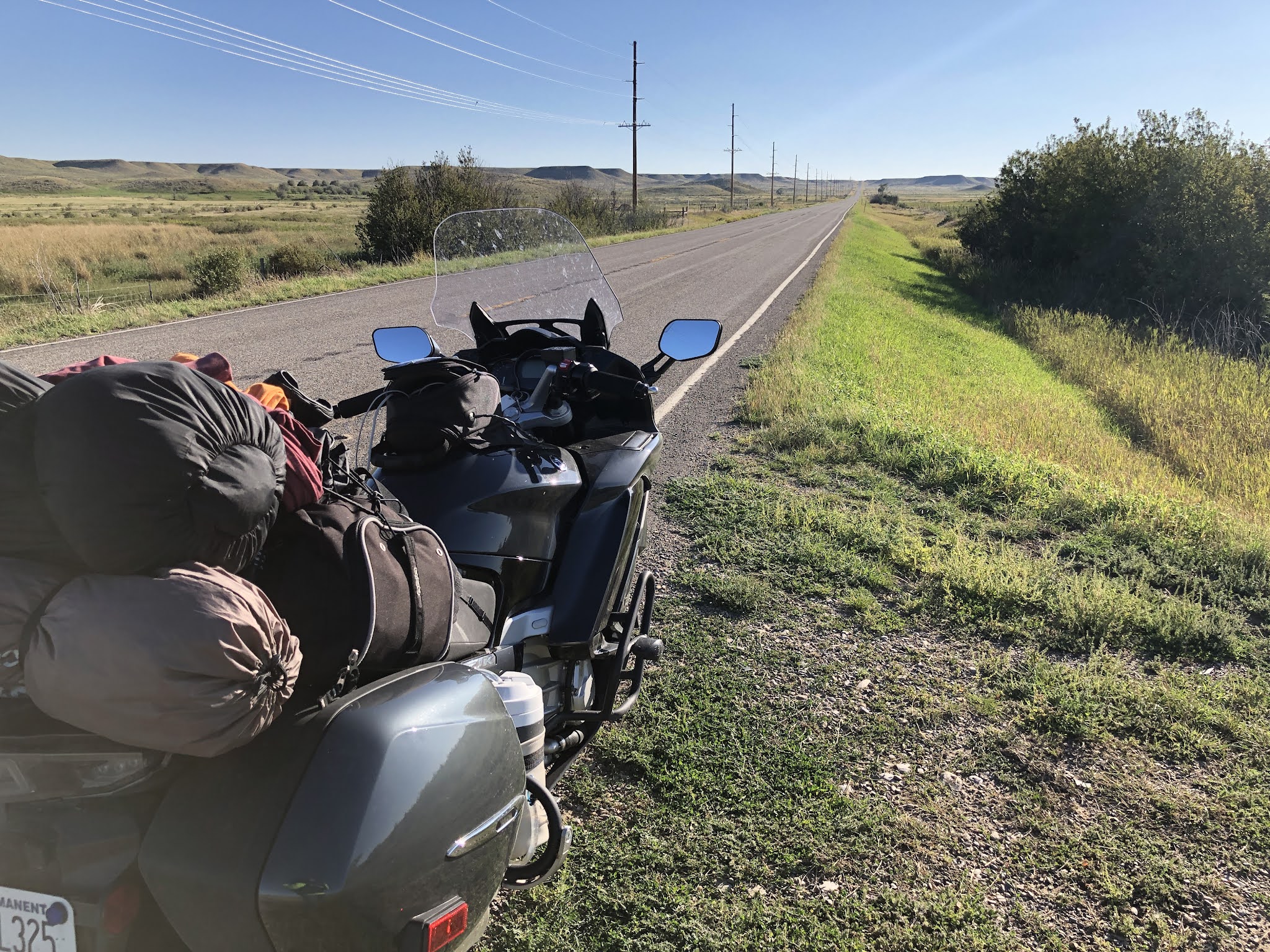
I continued north about as far as one can go before crossing into Canada and headed west on Highway 52.  It was very quiet and the roads are straight and flat, quite a difference from the roads back east


The next town of size is Crosby, ND and I searched out the courthouse for Divide County and another photo.


It’s also quiet this time of day.


Up the road I ran into more construction.  These guys have to work weekends.  It was a 6-mile project reworking the shoulder on both sides of the road.  As I was probably the first vehicle to show up in a while, I had to wait while they radioed for a pilot car to come down from the construction headquarters up on the hill to the right. 


The pilot car led me along the paved road and was there to make sure I didn’t get hit by the many semis pulling side-dump trailers or the excavating and earth moving equipment along the way.  I noticed they were bringing in lots of fill material and, up ahead, I saw they were flattening the top of a big hill for their borrow.  

It was somewhere along here where I ran into a plague of grasshoppers.  What a mess.

Not far from the construction zone I arrived at the Montana border.


About 5-miles later I was riding along with cruise control engaged when, all the sudden, it pops out of control and the cruise light starts flashing and the “engine trouble warning light” was illuminated.  Uh-oh.  I tried to re-engage the cruise and that wasn’t going to happen.  Other than lacking that feature, everything else seemed normal so, since it was running fine and I was in the middle of nowhere, I pressed on to the next town 

I rolled into Plentywood, Montana and hunted down the county courthouse for Sheridan County..


While parked, I shut of the ignition, waited a bit, and turned it back on.  The engine warning light was still on.  Hmmm.  Well, it’s not like I would find a Yamaha service center in Plentywood on a Sunday morning so I hit the start button and it started up and sounded fine.  Before I left, I texted my son, Dan, the motorcycle and automotive expert, and told him what happened.

I continued on and rode on to Scobey.  This was the first time I’d been to this part of Montana, it’s northeast corner, and not a place one is likely to pass through going someplace else so it has to be a destination of its own.  I’d wanted to see this area and it wasn’t disappointing.  The corn crops that had dominated most of my travels had transitioned to grains, I assume wheat and barley.  There were also many fields of smaller plants, pulse crops probably, knowing that Montana is know for growing lots of lentils.

Once I got rolling to Scobey I tried the cruise control and it worked just fine.  That’s puzzling but is also the nature of today’s high-tech machinery that is loaded with sensors of all kinds and several computers to keep things working together.  It’s nothing like my 1976 Honda CB750 that I did a similar ride on back in 1979.  That bike had 4 side-draft carburetors, a standard points-and-coil based ignition system, and very little wiring.  The likelihood of diagnosing and fixing something on the roadside with that bike was high in those days.  From that, we’ve traded up to a higher level of reliability, efficiency, and some creature comforts and safety features like cruise control, ABS brakes, electronically adjustable suspension, and traction control but with the added inability to work on problems in remote locations without hauling along lots of diagnostic tools.

I found the Daniels County Courthouse on Main Street in Scobey and read that it’s on the National Register of Historic Places.  It certainly does not look like most of the courthouses I’ve seen.


While stopped, I checked my text messages and Dan said it sounded like an “intermittent error” that self-corrected.  The engine warning light will remain on until the code can be read and then cleared.  

As I headed south on Highway 13, I really had the feeling that I was in eastern Montana.  The Big Sky and views unencumbered by trees.


I crossed US Highway 2, a road I’d been on and crossed numerous times on this trip, and continued on Hwy 13 but only for a half-mile.  I stopped behind a semi hauling hay that was waiting at a railroad crossing.


The train wasn’t going anywhere and I could hear its engine running at an idle to the right.  It appeared that it was stopped at a red light, probably waiting for another train to pass so it could continue on.


How long we’d be waiting would be pure speculation so I pulled up the navigation app and looked at an alternative route.  If I went back up to US 2 and headed west, I could cross the tracks in another town and it only added 15-minutes to my total travel time, so I made a U-turn, got back to US 2, turned left, and headed toward Wolf Point.

Back in 1991, when I was finishing up my student teaching in Southern California and looking at relocating, hopefully to Montana, I subscribed to a “Vacancy Newsletter” put out by the University of Montana in Missoula which listed open teaching positions across the greater Pacific Northwest.  While I was interested in Billings, I didn’t see vacancies in my teaching discipline there but I did notice there were always openings in Wolf Point, Frazer, Browning, and Busby.  A bit of research showed these were schools on the various Native American reservations in the state.  I wasn’t interesting in those positions because I really wanted a larger town and the economic efficiencies one brings.  However, I was always curious about what those communities looked like and I got my chance to see when I rode through Wolf Point and Frazer on my search for an alternative route around the train.  Wolf Point is the larger of the two but still a small town.  Frazer was really small though it does have quite an attractive school.

I got to Nashua and headed south on Highway 117 which took me directly to Fort Peck.  This is the home of the largest earthen dam in the United States and that holds back the Missouri River creating Fort Peck Lake, which is huge.  My wife and I came up here a few years ago to attended their summer theater and to tour the dam. Both are well-worth doing.  Today I just grabbed a few photos and kept rolling.

These towers are used for surge control in the power generating station.


Here I am looking back at the towers from on top of the dam itself with the afterbay showing on the left.


Here’s the lake to the left and the dam goes off in the distance to the right.


The remaining miles were all about covering distance.  I went south on High 24 for about 60 miles of rough road until I arrived at the junction of Highway 200.  There was a rest area there so I pulled in for a break and to fiddle with the music player on my phone.  A pickup pulled in and the driver rolled down his window for a chat.  He was waiting for his wife to show up in their car which they were leaving at the rest stop before heading to their cabin.  He talked about ranching in the area, the drought, and the welcomed recent rains that greened things up again.  He started going off on Native Americans when I veered the subject elsewhere.  His wife showed up and we wished each other a nice day and they headed out.  

I headed west on Highway 200 and hoped that I would find a gas station in Jordan since I was down to 2 bars on my gas gauge.  I lucked up and found one and, after filling up, knew that I had enough gas to get me back to Billings.  Although Jordan is pretty small, it is famous for the Freeman standoff with the FBI back in 1996.

From Jordan, Highway 200 continues on passed Winnett where I turned to go through the town and to get on Highway 244, a shortcut, to Highway 87 which would take me back to Billings.  Here’s a few shots on that shortcut road.


I pulled into my garage about 8:30pm.  It had been a long day and a long 3-weeks but all good since it was a motorcycle trip.  


Today’s ride was a personal record on this bike: 584.5 miles.  My PR is about 650 miles in one day going from somewhere around Reno, Nevada to Ogden, Utah in 1979 on my Honda CB750.


Here’s some stats from the trip:

Days gone: 21
Riding days: 19
Days off: 2 in Pittsburgh, one on the way out and one on the way back
Nights camping: 16
Non-camping nights:  1 night a friend’s in Lake City, MN  and 3 at son’s in Pittsburgh
Longest day: the last one with 584 miles in about 12 hours.
Total miles for the trip: 6,658 
Gas used: just guessing but I get about 55 mpg so about 121 gallons
Cost of fuel: this is recorded somewhere but I’m guessing at about $3.10/gallon so $375.  (Update: the accountant gave me my credit card charges for gas on the trip and it totaled $453.26.  One fill was for both mine and my sons bike.  Another two charges were actually for beer, so my estimate was pretty close.)
Total cost of the trip: calculated after returning, about $1,250.  This covers fuel, lodging (campsites), food and beer, toll over the big bridge, etc.  This does not include the cost or maintenance of the bike itself (oil change, tires, etc.)
Hours riding:  I could look back through the blog but I’d guess about 130 hours
Best road: all off them
Best part of the trip: Pittsburgh to Maine and back to Pittsburgh with my son
Worse part: traffic getting around the outskirts of Toledo, OH
Scariest part: Mackinaw Bridge

I’ll do a few more posts over the several days with some final thoughts, primarily so I have them written down where I can refer to them for future rides.  Yes, there will be future adventures.


Saturday, August 28, 2021

Day 20 - in Stanley, ND

August 28, 2021

The rain that greeted me yesterday continued through most of the night.  I stayed plenty dry since I’d set my tent up under the picnic shelter.  The only downside was that my air mattress has a leak and I’m on concrete. I fashioned a pad using the AirHawk seat pad from my bike and my cooling vest.  It’s crude but it works and, hey, it’s what camping is all about.  I’m not going for the “glamping” thing.

I woke up to a dense fog across the river and the sounds of big fish splashing on the surface.  


Some guys were camped down at the far end of the park but other than them, I’m the only one here.  I started the packing routine which takes about an hour and was ready to move out about 8am or so.  I went back up to Highway 11 but rather than head west toward Baudette, I did a 3 mile side trip going east again.  I use a site called Atlas Obscura that locates the more unusual “attractions” around the world and it said that “Basshenge” was nearby.  Sure enough, it was, carved out of a small clearing in the forest right alongside the road.  Here a link to the details on Atlas Obscura: Basshenge.

Basshenge is, of course, a play on Stonehenge but in this case it is made up of sheet metal sculptures mounted on concrete columns, with all the pieces making reference to the double bass musical instrument.  From the air they are seen arranged to form a bass clef.  This is pretty typical of what is found on Atlas Obscura, things simply not to be missed.


I headed down the road toward Baudette in a pretty heavy fog at times.


When I got to town I stopped for another photo opportunity, thanks to a heads up from Atlas Obscura.  Baudette claims to be the walleye capital of the world and in making that announcement they have a statue of “Wally” at the town enterance.


I know that a walleye is a fish but as a non-fishing person, that’s all I know but the town has plenty of bait and tackle shops, guides, outfitters, and rental places to assist the interested in pursuit of this piscine character.

Baudette has more that fish going for it.  AMI Pharmaceuticals has a big plant there and there is a automotive test track that some of the big companies use to test their products in cold weather conditions.  This is northern, very northern Minnesota after all.  When I think of this part of the state I’m always remind of the references to “Frostbite Falls, Minnesota” on the Rocky and Bullwinkle show from years ago.

Not long after I left Baudette the fog made a quick transition to rain.  Dang.  The weather app said it was likely to be clear today but it came down heavy for the next 20-miles of so.  Then it turned dark, there was horizontal lightening overhead, and the rain came down harder.  This is wide open farmland with no shelter in sight.   At one point I experienced a short hydroplaning adventure when the road was completely covered with water.  It was momentary but it sent a message: slow down.  I got to Roseau and some of the streets had started flood so I pulled into a gas station to hide out under their canopy while I pulled on my rain pants.  I checked the satellite view of the weather it it looked bad.


When I ran the animation it looked like I was going to continue to get wet, however, the worse of it was to the south and it was moving to the northeast.  I decided that if I took off now I might be able to outrun it so off I went.  

After a few miles the rain lightened up and I even saw some chance of it stopping as the sky up ahead lightened.

I went through Warroad, the home of Marvin windows, and was impressed by the size of their factory.  It must have been 8-blocks long.  Up ahead things cleared up and I stopped for some roadside photos.


I needed a break and, just in time, a wind farm showed up with a pullout and explanatory signage.


I needed a snack and dug these out of my bag.


These roads I am riding on today are as straight as a ruler.  Maybe a few hills but it’s mostly flat.  I would ride on one road to the west for 20-miles and turn right, north, go on for 1- to 2-miles and then turn west again for another 20-miles.  Rinse and repeat.  I went through sections that were infested with grasshoppers as I could feel them hitting my feet and, at one point, one landed on my tank bag in front of me.  It will be a mess to clean off when I get back to Billings.  Sorry, no pictures of that, yet.

I made it to Rugby, North Dakota and spotted their county courthouse so added another one to my collection.


Rugby has the distinction of being the “Geographical Center of North America” so I found the monument and grabbed a photo.  There was a Subway across the street so I went there for a late lunch/early dinner.  Their veggie sandwich has been a staple of this trip.  It’s like a salad in a piece of bread.  Good stuff.


I gassed up and headed west on US Highway 2, again, and this section was stretching my goal of staying on the secondary roads.  It was a 4-lane, divided highway with a speed limit of 70 mph, but it had stop lights, cross traffic, and speed limits through the towns it crossed so I guess it counts.  At lunch, as is my routine, I’d searched online for camping options and saw that the town of Stanley, ND had camping in a city park.  I’d had a good experience with small town city park camping in the past so I set my navigation app to take me there.  The campground is right across the street from the Mountrail county courthouse so I’ll bag another photo while I’m here.  It’s a small site, about a dozen spots, right on Main Street and adjacent to a railroad that has something rolling down the track once an hour or so.  I don’t consider those a nuisance, more like just part of the atmosphere.  

Only three other spots were taken when I pulled in.  The instructions said to walk across the street to the courthouse to register but since it was the weekend and after a hours it gave me a number to call.  It was answered by the sheriff’s office and they said they’d send someone right over. Sure enough, a few minutes later a sheriff's patrol car pulled in and registered me.  It’s supposed to $15/ night but when he saw I was tenting he said it was only $7.  What a deal with flush toilets and a shower too.  The officer and I had a nice chat about the town and his job.  He’s the only one on patrol and another officer is on-call in case something big happens.  Their third and remaining officer has the day off.  The only other policeman in town is the chief who has been in that position for almost 30-years.  He told me that he’d worked 4-years on the nearby reservation and that was pretty busy compared to working in Stanley.


So, I got the tent set up, unloaded my gear and sat down to write this while enjoying an IPA I brought with me from yesterday’s stop.  It looked like rain for a bit but now it’s clear.  Maybe I’ll have some dry weather for a while.

Today’s ride was 451 miles for a total for 6,071 miles on this trip so far.


Friday, August 27, 2021

Day 19 - on the Border along the Rainy River

August 27, 2021

I suppose it was bound to happen, after all, I’ve had 2-1/2 weeks of pretty good weather but the outlook and result of today’s was pretty dismal.

It rained a bit overnight but stopped by the time I got out of the tent about 6 am.  I’d put on my running shoes and wanted to check out the snowshoe trail that is a couple hundred yards from my site.


From the map it looked like it was a loop about a mile and a half and I figured I could easily run/hike it to check things out.  It is quite lush and, amazingly, free of bugs.  I didn’t even see a mosquito in my camp last night.  There have been some trail improvements by Eagle Scouts who built bridges across some drainage areas but most of the trail was just cut through the forest and the thick underbrush.


I ran some and walked some and eventually got to the branch of the trail that went out to an old sandstone quarry.  I followed it and found the pit, full of water, and some signage that explained its history.


I followed the trail around the quarry and on one side it ran along a river that had carved out a small canyon.


I continued on and saw a small waterfall but beyond that were some man-made structures, long since abandoned.  From the description on the sign, it was part of the sandstone mining operation that existed from 1887 to 1907.


After the hike I got cleaned up, packed up, and back on the road.  Before getting back to the main highway I passed a group of wild turkeys and, a bit further on, a bald eagle.

The route I’d set up would take me through Superior, WI and Duluth, MN before heading north to International Falls.  I’d never been that far north in the state and figured this would be a good opportunity to check it out.

I’d made two trips to this area in the past.  About 15-years ago I ran Grandma’s Marathon in Duluth which started in Two Harbors, 26.2 miles from the bridge area of Duluth, north along Lake Superior.  It was lots of fun except that by the time I finished (4:37) the temperature was 82 and the humidity about matched that.

The other trip was a few years later when my wife and I did a car trip through the Iron Range of Minnesota, checking out the big mining pit just outside of Hibbing, Bob Dylan’s hometown, before driving the coast road, Highway 61, up to Thunder Bay, Ontario.  We came back down the coast and checked out Duluth, particularly the Glensheen Mansion, definitely worth the tour, with a more recent violent history.  Fascinating place.

Today, there was no sightseeing.  As I traveled through Superior it started to drizzle.  By the time I got to the Richard I. Bong Memorial Bridge to cross St. Louis Bay into Duluth, it was a full on rain with a strong cross wind off the lake.  The navigation app, thankfully, routed me around most of Duluth and I was starting to get wet every time I stopped for a light or a stop sign.  I had my rain liner in my jacket but hadn’t put on my rain pants because I didn’t anticipate this storm.  While moving, the fairing and windshield  on the bike do a good job of routing the water around me but stopping in a downpour is something else.  I stayed on Highland Ave. for 6 miles until it came to the junction with Highway 53.  I turned north and had to get past any fear of riding at 60 miles per hour in a heavy rain because that was the flow of traffic.  Hwy 53 is a 4-lane, divided road with a speed limit of 65 mph so everyone, plus all the semis, are really scooting.  About 20-some miles later it becomes a 2-lane road and the traffic greatly diminished. 

A sign of relief showed up when a Rest Area appeared about 40-miles out of Duluth.  I needed to add another long-sleeve shirt over the one I was already wearing and to dig out those rain pants.  The upper parts of my Levis were pretty wet already but I was in search of warmth, not dryness.  I also donned my waterproof and insulated winter gloves and when I got back on the road, in spite of the rain, I felt pretty good.  

I planned to stop for gas and, maybe a late breakfast in the city of Virginia, but all I got was gas.  Traffic was a mess.  Don’t these people have jobs?  I headed out and stopped for a sandwich in Cook, MN.  The rain had almost stopped when I got there but was on again when I left.  I’d looked at a radar map and the storm was moving north and I was barely outrunning it.

I made it to International Falls and rode past the bridge that announced “To Canada” and wanted to go back for a picture but the city streets are so torn up with construction that I gave up and set the navigation app for points west.  My goal was to make it to the northwestern corner of the state and camp there but that wasn’t going to happen.  As I started out of town, heading to Highway 11, it started raining.  Hard.  Really hard.  I could only see about a 1/4 mile up ahead and, luckily, there were few other cars out.  I started wondering why I was even out here.

I got about 40 miles into this part of the ride and thought “That’s it. This is crazy. I need to stop.”  I had gone quite a ways since I'd even seen anywhere to pull off, just miles and miles of woods and forests so when I saw a sign for “Nelson Landing” that had icons for boating, fishing, and camping, I made the turn.  The road took me down to a site along the Rainy River, quite appropriately named today.  It’s a county boat launch but has about a dozen campsites and it’s free.  There are 4 RVs here without cars so, for now, I am the only one here.  The rain is still coming down and rather than set up camp in a regular site, I commandeered the picnic shelter.  My tent just fits between the two picnic tables.  The river is just a few feet away and that is Canada on the other shore. This will have to do for the night and I’ll just have to see what tomorrow brings.  

My weather app indicates that the town of Baudette, about 30 miles to the west, will have rain into this evening but clear by morning.  After that it looks pretty good for continuing on westward.

This was today’s route, blue one.


Today’s ride was 235 miles.  Also, my bike went past the 10,000-mile mark today finishing the day at 10,030.  I’d have stopped for a photo but my mind was on other things.

A pie ride but no pie today

April 25, 2024 After seeing this story in the local news, Klo’s Kitchen: 17-year old opens bakery in heart of Harlowton , I thought it make ...