September 15, 2023
With beautiful weather and nothing pressing on my calendar, its a perfect day for a ride. I’ve been wanting to do a ride to Yellowtail Dam and that made a perfect destination for today. However, exercise comes first so I met Shelley for a run at 5:30 am and we logged about 4-1/2 miles as part of the Run All of Billings Project. Today’s run is blogged
here.
After returning home, getting cleaned up and fed, I packed a lunch, loaded up the bike, and was pretty much ready to go when Keith pulled up a bit before 9 am. He rides a 1977 Goldwing. We chatted a bit before I grabbed my helmet, jacket, gloves, and tank bag and got on our way.
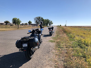
We wove through the quieter streets of Billings to get to South Billings Blvd. which takes us south out of the city. The weather was perfect, about 70 degrees, clear skies, and no wind. The road, Hwy 416, goes over hills and has some sweeping curves before it ends at Hwy 418, AKA Pryor Road. We turned south here and about 20 miles later we are in the small town of Pryor on the Crow Reservation. We made a quick stop for photos before heading east.
The road is Hwy 91 and there was a warning sign that indicated “Rough Road” for the next 40-some miles. I’ve done this ride several times and it is a rough road due to some potholes, some patches, and some rough cattle guard crossings. 50 miles per hour is a reasonable speed.
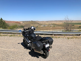
We stopped along the way for a gander at the scenery.
About 20 miles into this road we passed a half dozen cattle cars lined up for loading, well, cattle, at a corral. It was a depressing sight so I didn’t stop for photos.
The next town is St. Xavier and it’s pretty small and has some abandoned buildings, like this one. This is at the corner of Hwy 91 and Hwy 313.
Looking south.
The abandoned school is nearby.
The next 20 miles took us to Fort Smith. I think this place survives on tourism (boating and fishing) and the nearby Yellowtail Dam. It a small place but they did have a gas station.
We continued on toward the dam but when we were about halfway up the hill we encountered a barricade. It was like this the last time I was here, probably about 15 years ago, and even though I’d looked online and saw some indication that they might be allowing visitors, I guess not. But scenery is pretty good.
Keith knew how to get to the marina above the dam so he led us up that way. It’s about 10 miles and the road has lots of curves and cattle roaming on it. We arrived at the marina and parked above the boat ramp. Being post-season and a weekday, it wasn’t very crowed, in fact, not crowded at all.
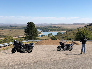
We sat in a nice picnic shelter and had our lunch. Afterwards, we walked around the grounds. In the photo below, the dam is just around the far corner on the left.
It was time get going and we headed back up the hill. I kept my eye out for a place to pull over that would give us a view of the dam and I didn’t find one so just pulled to the side of the road.
On the way out we checked out a few roads near the afterbay and took a look at the campground. Camping there is about boating and all the sites are parallel to one another in a long line.
We headed back out and took Hwy 313 to Hardin, a nice ride past miles and miles of farmland. In Hardin we turned west on Old Hardin Road, Hwy 87, and took road that back toward Billings. When we got to Pryor Road we stopped for a break.
We took the twisty roads to Lockwood and then crossed the Yellowstone Rive into Billings, weaving our way through the industrial part of town and then up 27th. We stopped and topped up our tanks, said our goodbyes, and then went our separate ways.
When I got home the trip counter said we’d done 217 miles. A most excellent day.


No comments:
Post a Comment