May 7, 2021:
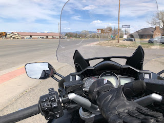
The weather looked great with only a minor chance of afternoon rain, so I headed out to do a couple hundred mile ride. I decided to go to Powell, WY because I wanted to bring back a non-alcoholic beer made by Athletic Brewing that they don't distribute in Montana, plus, Powell would would be a good loop and bring me close to Heart Mountain and the internment camp museum nearby.
My plan was leave mid-morning but I got consumed with finishing the gate project that I showed in the previous post so I didn't hit the road until about 1pm. Knowing that I still had time to do the ride but would have to forego the museum until another time, I headed out.
I took the River Road route from Billings to Laurel, always a nice drive with lots of curves, and then Highway 212 from Laurel to Rockvale where I turned south on Highway 310. This is a nice 2-lane road through farm and ranch land. In Fromberg I pulled over and parked next to an abandoned garage.
I'll have to come back here with my sketchbook. It just begs for some sketching and watercolor.
The next stop was just outside of Bridger, MT where there is a nice rest stop adjacent to the intersection with Sand Creek Road.
Heading on south I stayed on Highway 310, noting that Highway 72 veered off to the right, the road I planned to return on. 310 continues on for quite a while and crossed the state line into Wyoming.
It seemed like once into Wyoming the scenery really opened up. I came to little towns of Frannie and then Deaver. Not using a GPS or a map, just sort of riding from memory, I forgot that Highway 114 in Deaver would take me south to Garland which is only a few miles east of Powell. I continued on 310, past Crowley, and eventually landed in Lowell, WY. Hmmm, I don't remember this being on my itinerary but I'll go with that and drove around the town a bit.
It seems that the big business there is a bentonite mine and processing plant. I checked the map on my phone and saw that if I turned around a rode back a few miles, I could take Alt 14 to the town of Byron which would then take me to Garland and Powell.
I arrived in Powell at 4pm and was greeted by a nice park and a rest area. I needed the break and also it was time to check my phone to find the liquor store I was looking for.
Mr. D's Food Center was where the beer was to be found. When I got there I found the food store but, probably a state law thing, the liquor store was in one end of the building with its own entrance. I picked up a 6-pack of IPA, which fit perfectly in one of my saddlebag liners, got my gear back on, and headed west out of town.
I knew that I wanted Highway 294 which was just past the town of Ralston, but I almost missed it. Usually there's a sign that shows the highway number and a town that it goes to, but if there was one, I missed it. (I went back later on Google Street View and still couldn't find it.) All the sudden there it was and I did one of those quick slowdowns, got over into the right turn lane, made the connection, and headed north.
I suppose that one reason there wasn't a sign indicating where the road goes is because it really doesn't go to anything but just travels north. It's a 2-lane road that's about 20-25 miles long with curves and hills. It goes through some badlands-type terrain and it was here that I met up with the crosswinds that, rather than steady, came in gusts. Luckily, there wasn't much traffic on the road so I could ride the left portion of the lane to give myself a little more room to get blown around. I did use this as a training experience and noted how the bike behaved when a gusts would blow by. It really does hold its place on the road even though I am acting like a sail.
The road ended at the intersection of Highway 120 where I turned right and took that north, back across the state line into Montana where it became Highway 72. The next outpost of civilization was the town of Belfry, population of about 200, surrounded by agricultural land. I decided to take a break and parked in front of the Belfry Country Store which appeared to be closed and up for sale.

From here the road took me north, following the Clarks Fork of the Yellowstone River, to where the road merged with Highway 310 just south of Bridger. I followed the route back to Laurel the same way I'd come but instead of of taking River Road back to Billings I decided it was time for a new experience and for the first time took the bike on the interstate. It's only 10 miles or so from Laurel to Billings on I-90 and the bike and I did just fine. I exited at Zoo Drive and worked my way over to 32nd Street to take that north rather than negotiating the 8 roundabouts on Shilo that would get me to my end of town. In car I don't mind them but on a motorcycle, with Billings drivers, 32nd Street is a safer alternative.
I arrived home about 6:30 pm after 221 miles. And the beer was still cold and it's not bad.


No comments:
Post a Comment